Coming soon in Q1 2026
ClearText realtime ATC Transcription, never say "Say again?"
ADSB receiver integrated in AI Copilot that guides you in real-time in all phases of flight
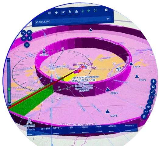
Stunning 3D Map
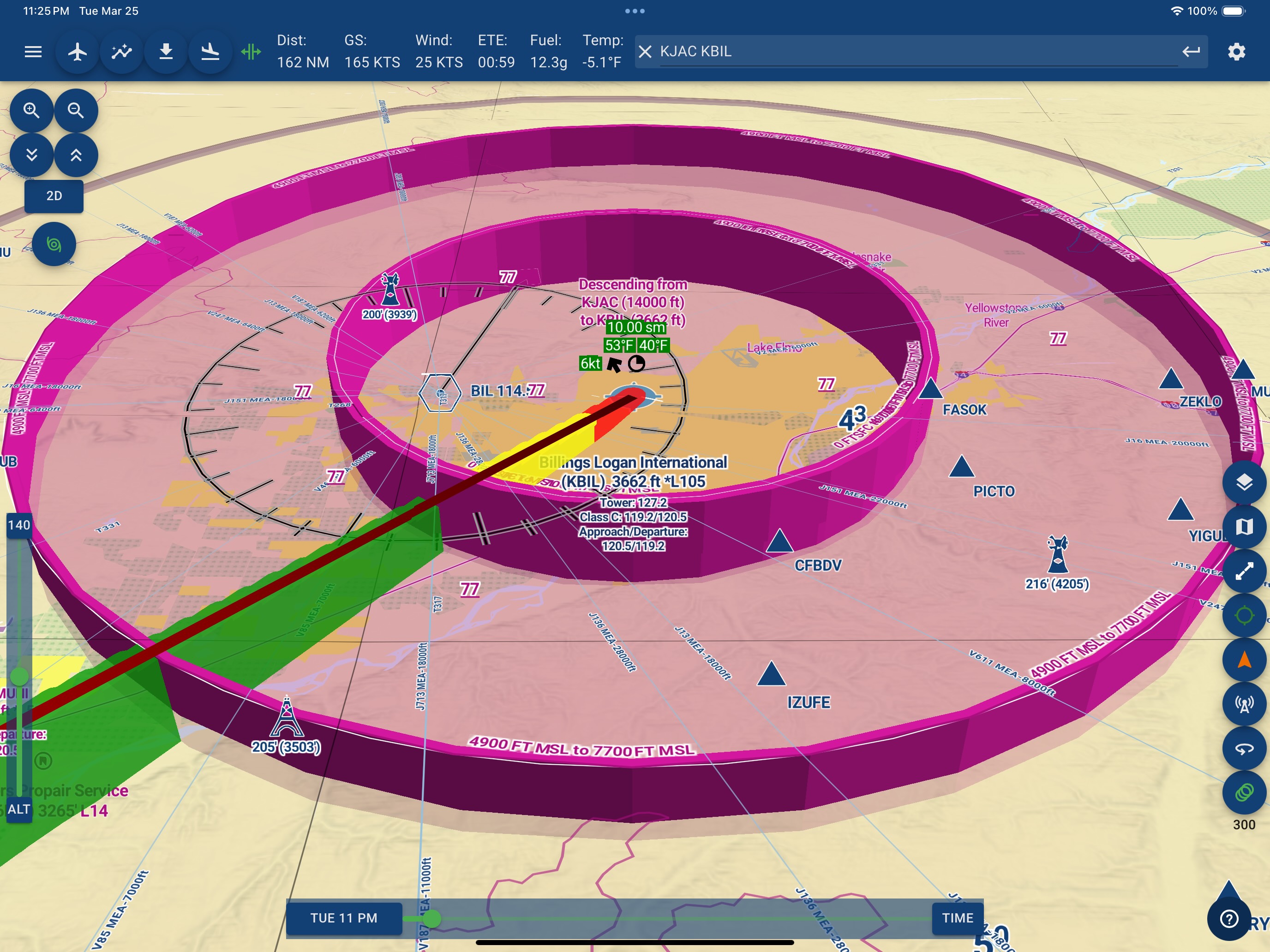 Stunning 3D Map
Explore the Sky in True 3D
- 3D Vector Maps & 10 meter resolution Terrain — nationwide
- Airspaces, obstacles, traffic & terrain are rendered in 3D
- 3D Satellite Imagery (3.6 meter NAIP) with terrain wrapping
- Smooth GPU-accelerated map engine written in web's newage language — Web Assembly: 2× faster than other Web maps
- Splitscreen display - see Raster + Vector maps simultaneous — IFR or VFR side-by-side
ClearSky™ AI Flight Planner
 Finds suitable flight windows upto 10 days our
🧠 ClearSky™ AI — Smarter Planning in Seconds
ClearSky™ is our new AI assistant for route planning and weather risk detection. Tell us your mission. We'll find your good time to fly.
- Choose any trip — today or 10 days out
- “I want to fly to Burlington for a $100 burger this weekend”
- “Best 3-day window to visit Ogden, Utah from Hillsboro, Oregon next week?”
- ClearSky™ finds best VFR/IFR time slots, routes, alternates
- AI suggests VFR/IFR slots, departure windows, alternates
- Considers METARs, TAFs, GFS/NAEFS forecasts, convective outlooks
- Response Time: 8–12 Seconds
- Powered by GPT‑4.1 today
- On-device model training is underway for offline support targeted Q1 2026
- ClearSky™ is now available - Included with all accounts
X-Plane Integration
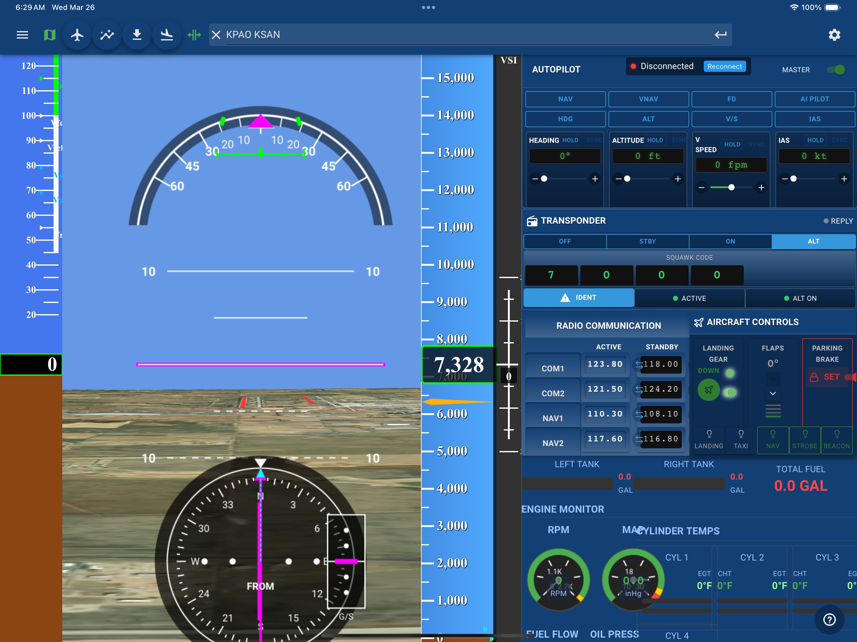 AvNav + X-Plane: A Virtual Cockpit, Reimagined
- Allows you to move your X-Plane view forward for a clear, unobstructed view - Perfect for VFR or IFR—ideal for sightseeing and proficiency training
- Two-Way Flight Plan Sync: Load and fly approaches with ease
- Full Synthetic Vision with 3D terrain and satellite views
- Touch-Friendly Controls: Manage the entire cockpit at your fingertips - all Gauges & Instruments—no more fumbling with knobs and dials
- Full Autopilot Control & AI Pilot integration
- “See It Before You Fly”: Explore every approach in AvNav + X-Plane
Smart ADSB
 Raspberry Pi-Powered Devices
- Panel-Grade Portables at a Pilot-Friendly Price
- Dual-band ADSB (978 and 1090 Mhz) with Subscription-free Weather
- Custom-Engineered PCB—Designed in the USA
- High-Precision GPS, AHRS and CO Detector included in Every Unit
- 🆕 Live ATC Transcription (Experimental)
- Decodes 118–136 MHz ATC traffic (COM1-like receiver)
- Transcribes traffic calls with timestamps and call signs
- Compact, Flexible Mounting Options—All You Need To Fly
Join hundreds of pilots already planning with AvNav® — the 3D + AI EFB for smarter flying
 >
>