

Great total EFB app! Very comparable to Foreflight, but not near as expensive when you compare with purchase of iPad plus the app! I don't have an external GPS unit; but, I'm impressed with its accuracy...
AI-powered, 3D-first Flight Intelligence
Trusted by pilots from Sun ’n Fun to Oshkosh, and featured in In Flight USA (November 2025 issue)

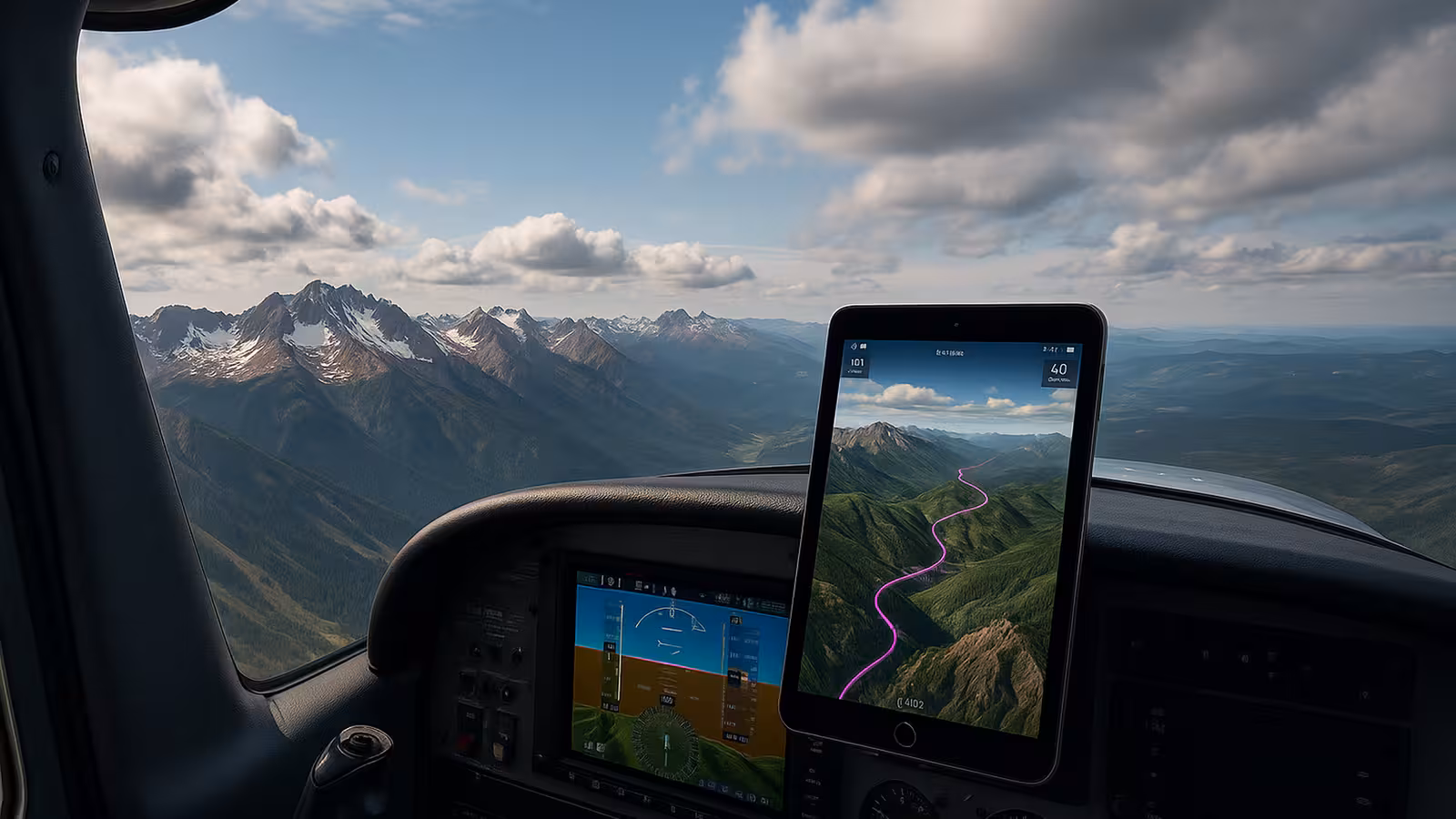
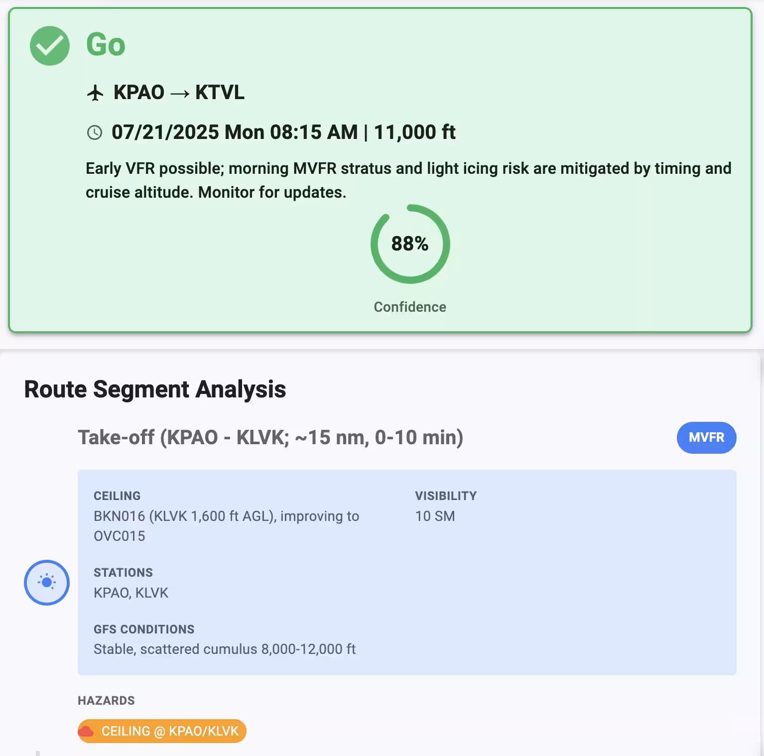
ClearSky™ AI forecasts safe VFR windows up to 10 days ahead — plan with confidence over stunning 3D terrain and airspaces
AvNav is redefining EFB - with new 3D Terrain Maps, ClearSky™ AI flight plannnig and exciting new hardware using AI accelerators.
Android's best EFB since 2014 - now comes to iOS and all other platforms - Windows, Mac, Linux, Raspberry Pi.
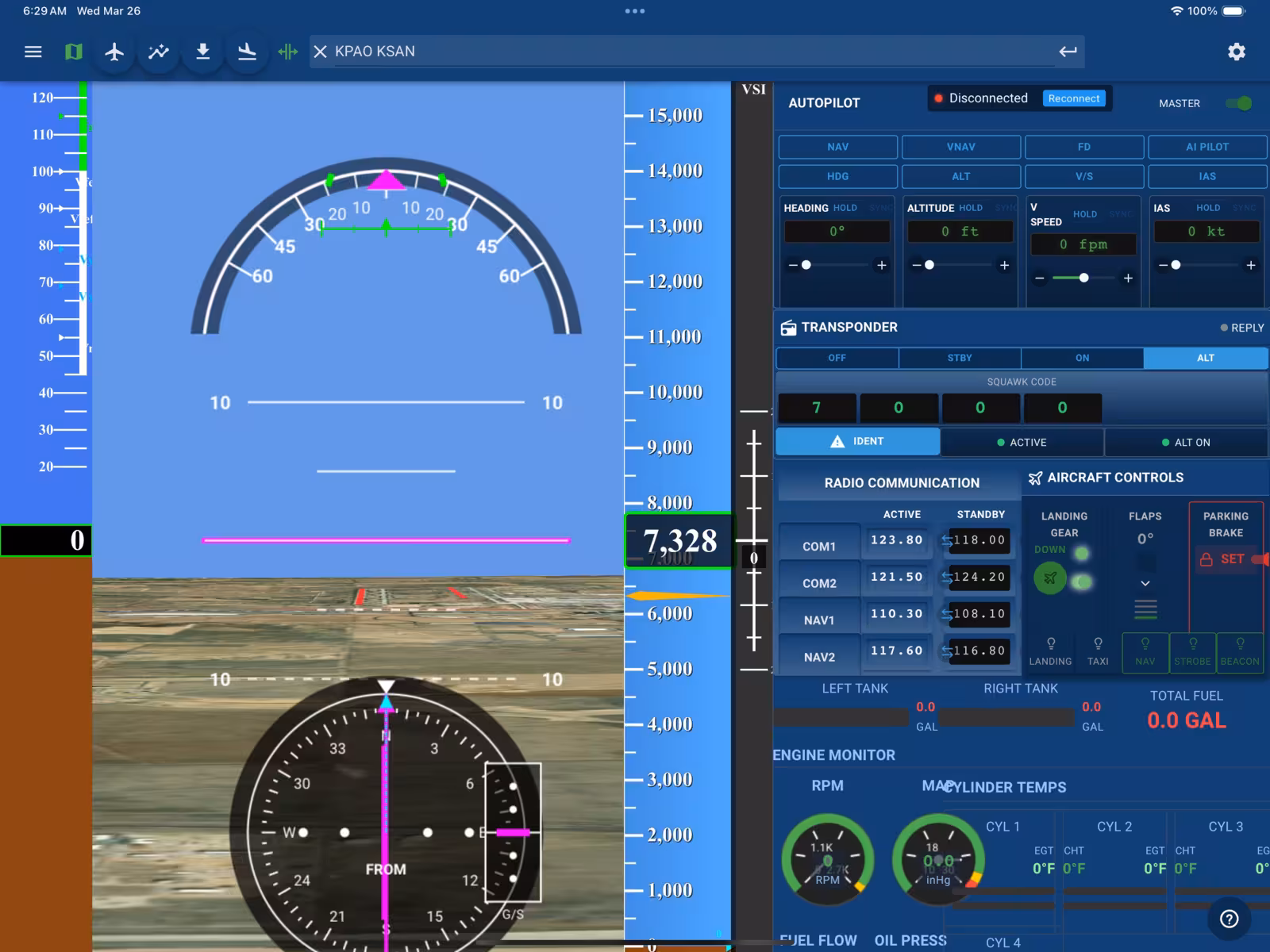
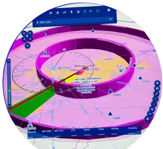
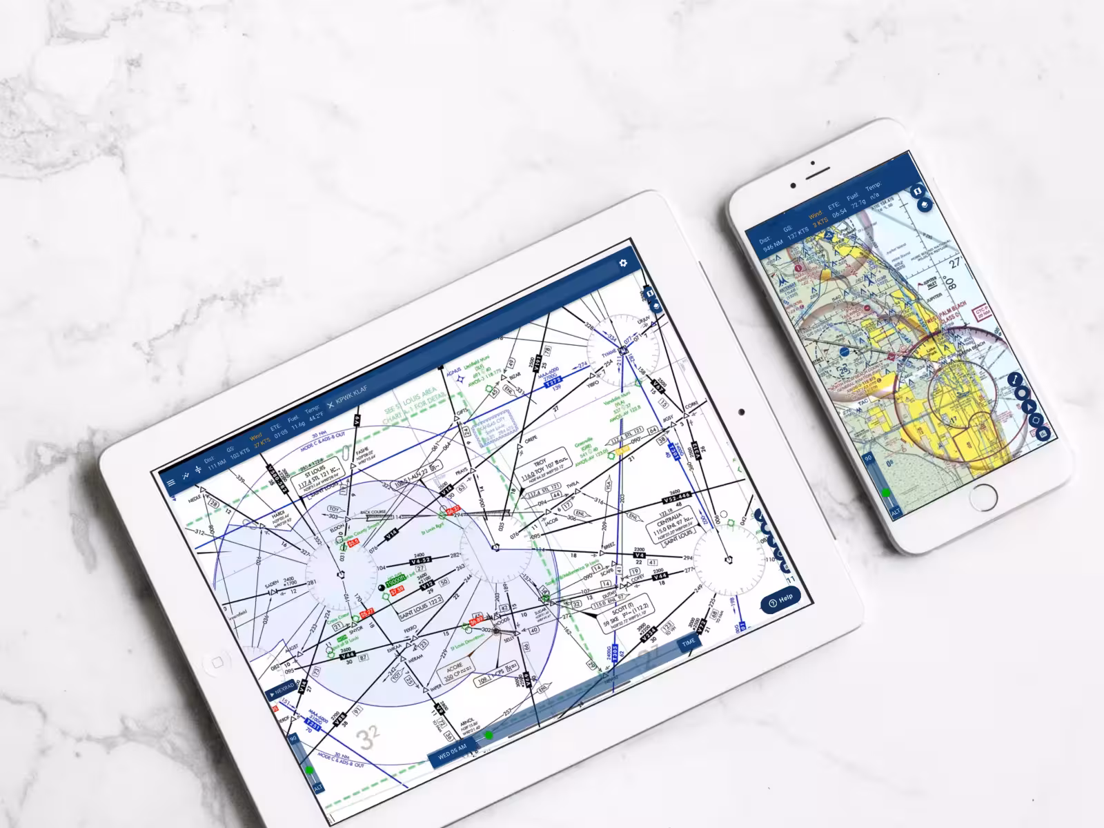
AvNav® supports Victor airways, DPs, STARs right in your flight plan.
AvNav runs on the newest language of the web-WebAssembly. So it's fast everywhere - Mobile phones, tablets and the desktop web.

An affordable and formidable alternative to ForeFlight. Easy to use, easy on the wallet.

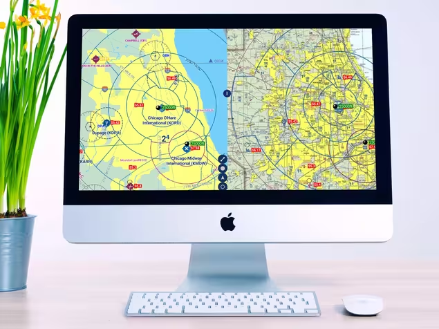
AvNav® is a responsive web app that runs fullscreen without browser frame. It utilizes all of your screens to the max-whether it is a mobile phone, a foldable device, or a large 5K monitor!
An affordable and formidable alternative to ForeFlight. Easy to use, easy on the wallet.
AvNav is a Progressive Web App - a breakthrough technology that allows Web Apps to work offline. There is no internet required once you have downloaded charts and maps for offline use in cockpit.

I would give it many more stars if I could. It has everything A pilot VFR/IFR could need with just a couple of finger taps.
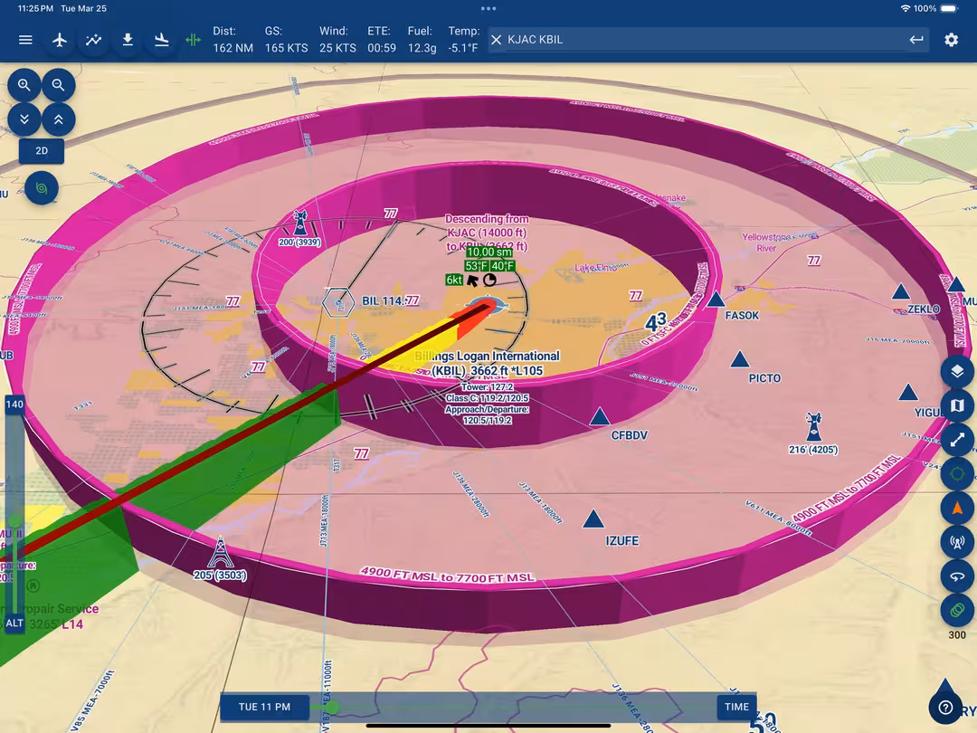
AvNav® has a clear, intuitive Vector Map with Overlays of continuously updated METARs, Nexrad, TFRs, and MOS Forecasts. Get the full picture and zoom freely with AvNav!

I've used Garmin Pilot, Avare, and Fltplan Go. All have their good points. But Avnav is simpler, more straightforward, and has my money. ATP, 4 type ratings, CFI etc. Nexus 10.
Enjoy highest quality FAA Charts and Vector Maps - no flickers or lag! Raster Sectional, Low and Hi Altitude IFR charts are included

Incredible! Haven't flown for 20 years, just got back flying again. This app made a huge difference to get started again. Great program!
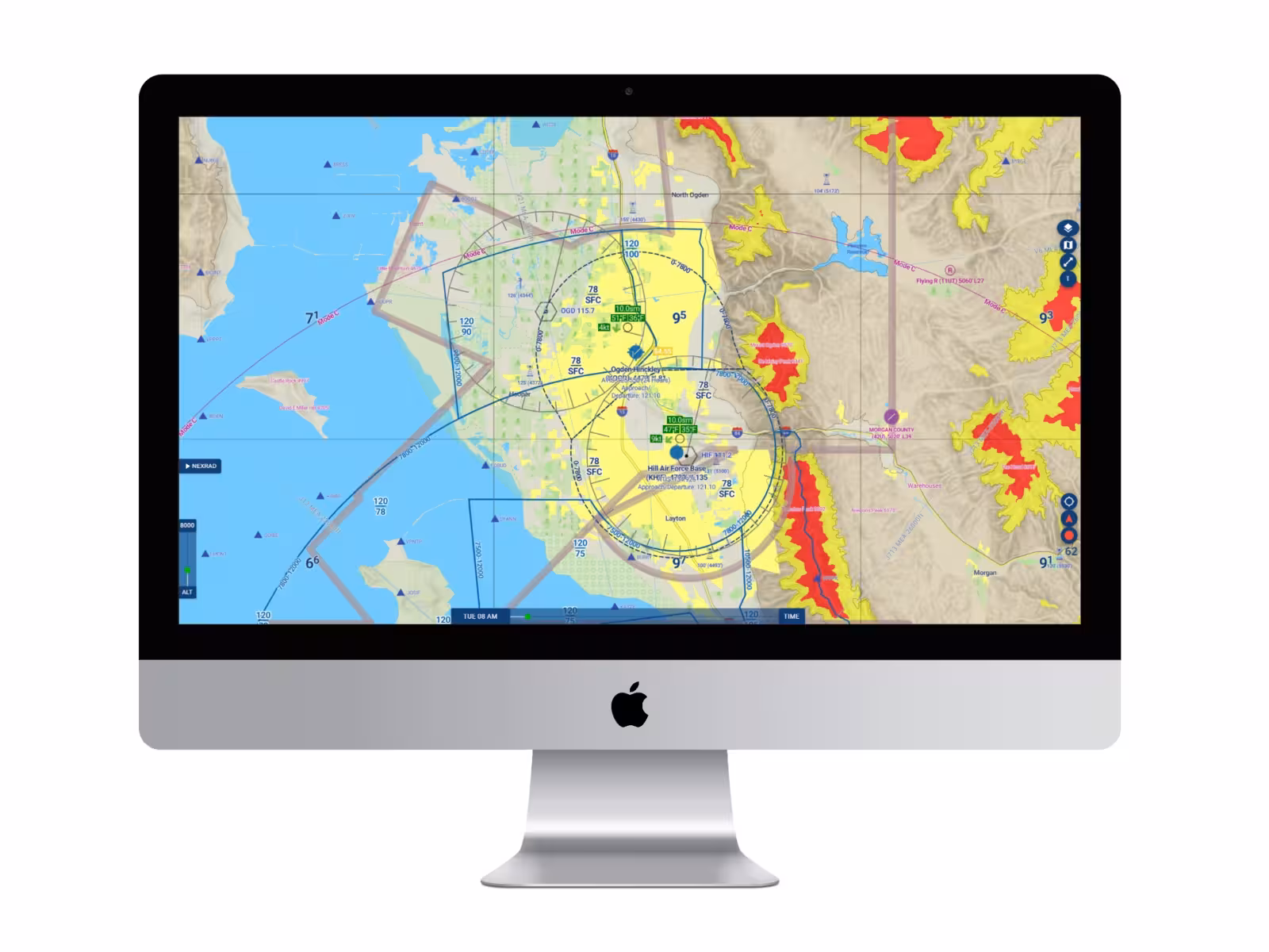
AvNav® shows your GPS position on the charts. AvNav gets information from Stratux ADS-B receiver to display updated traffic and weather on the map.

This app has a very user-friendly and intuitive interface. The on-the-fly rubber banding is great, the flight planning features are as good as or better than other Android apps and the ability to load approaches/SIDs/STARs sets this one above the rest.

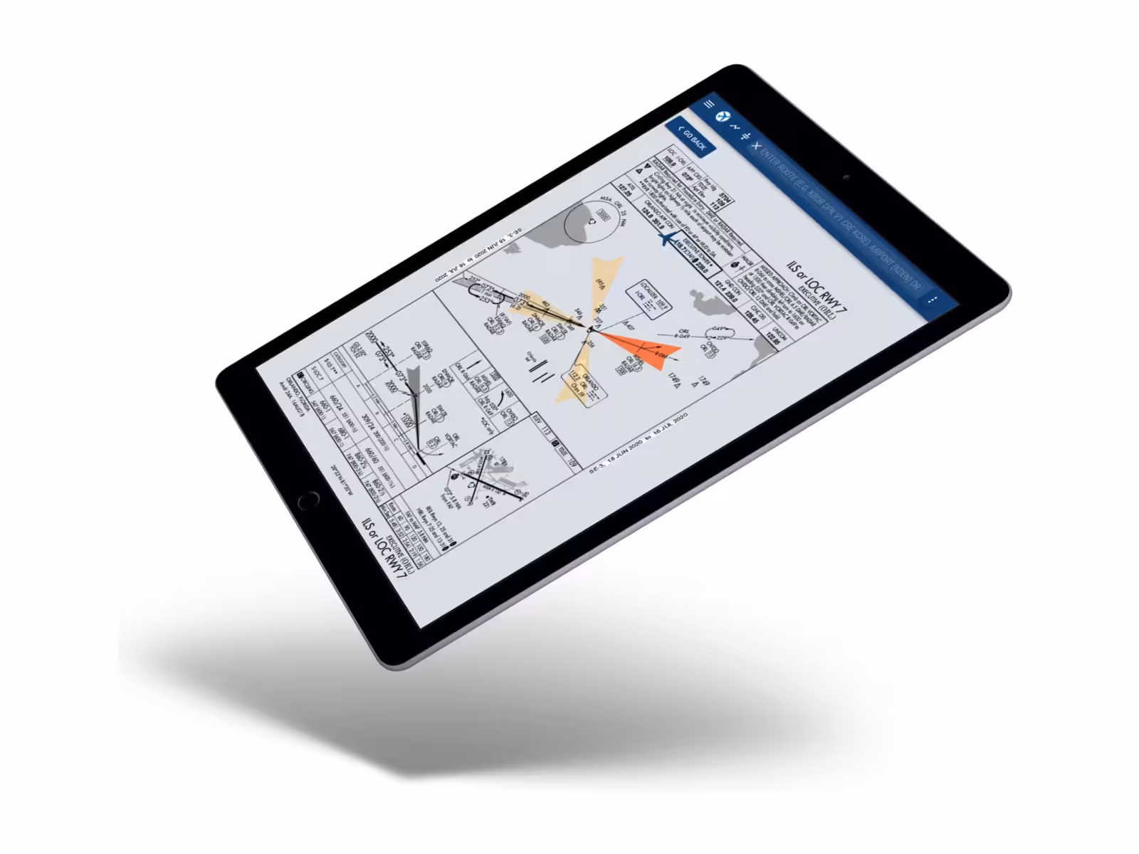
AvNav® displays position of your aircraft on Airport diagrams and Approach plates. Overlay Approaches Plates and Airport Diagrams on the map to combine them with Weather and Terrain display!

Awesome App I trust AvNav. Please keep up the excellent work. Two thumbs Up
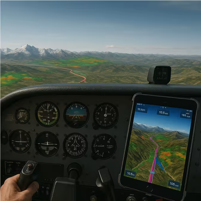
AvNav® has advanced display of terrain and obstacles. Terrain color changes continuously to reflect your altitude and clearance from surrounding terrain. Terrain can also be shown hillshaded.
This app has a very user-friendly and intuitive interface. The on-the-fly rubber banding is great, the flight planning features are as good as or better than other Android apps and the ability to load approaches/SIDs/STARs sets this one above the rest.
AvNav® EFB provides comprehensive information on all of flight planning needs including FBO Information and Fuel prices. Fuel prices are shown on the map page and updated daily. Savings from one fill-up alone can pay for years of AvNav subscription!
Awesome App I trust AvNav. Please keep up the excellent work. Two thumbs


Great total EFB app! Very comparable to Foreflight, but not near as expensive when you compare with purchase of iPad plus the app! I don't have an external GPS unit; but, I'm impressed with its accuracy...

Works as described and equals or exceeds Garmin Pilot. Cheaper than GP.

Finally a dependable app for pilot android users. I give this a five-star rating.
Joe Caroll
Join hundreds of pilots already planning with AvNav® — the 3D + AI EFB for smarter flying